
TOWN CENTRE WALK & FARNCOMBE TREE TRAIL
THE FARNCOMBE TREE TRAIL
The Farncombe Tree Trail, devised by local resident Martyn Sandford, is a route guide that you can either download to your smartphone or print out and take with you. It is a circular walk, looking at trees on the land that was once part of the Broadwater estate. A large part of the estate now forms Broadwater Park but you will also find interesting trees on the way to the park. The walk is mostly along made up pavements and footpaths with only a short section along a more informal path. You can also follow the route on a smartphone direct from the Plotaroute website.
The menu in Plotaroute (top-right) allows you to bring up the ‘Directions’ which include the tree descriptions and there is also a menu for selecting the map style. The ‘Paths Map’ is good for walking.
Alternatively, you can download a copy of the Farncombe Tree Trail here.
Further Information
SELF-GUIDED WALK AROUND GODALMING TOWN CENTRE
We suggest you allow 90 minutes.
The walk starts at the corner of Mint Street & Station Road (a short walk from Godalming Station and immediately next to the Mint Street Car Park).
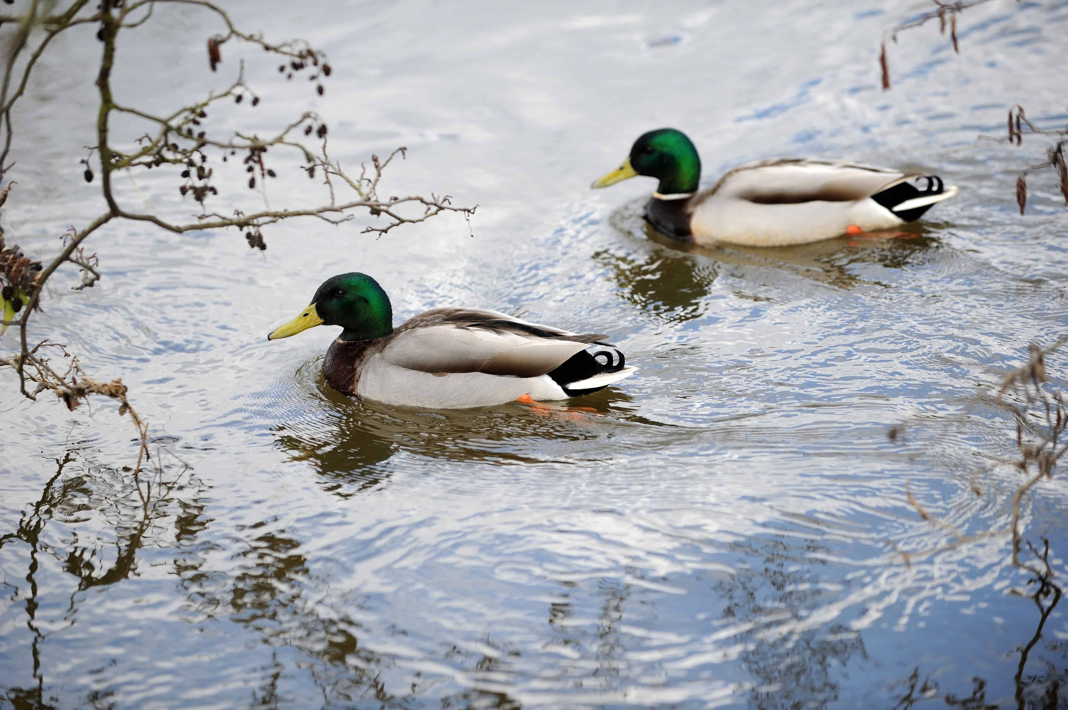
Ducks by The Mill, Mill Lane, Godalming
Photo courtesy of Darren Pepe, 2016

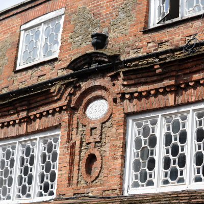
The Pepperpot, Godalming c.1814
Photo courtesy of Darren Pepe, 2016
Flemish-style Brickwork, Godalming High Street, c17th Century Finger Posts, Godalming
Photo courtesy of Darren Pepe, 2016
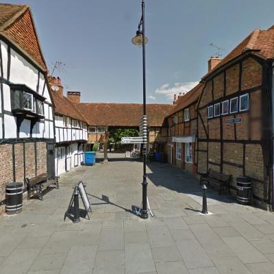
Crown Court, Godalming

Godalming Town Council Offices
Photo courtesy of Darren Pepe, 2016
- At the corner of Mint Street you will see the Georgian property – Brook House. Percy Woods, Godalming Historian was born here in 1842.
- Cross Station Road and go behind the railings to enter the cul-de-sac part of Mint Street.
- Minton Cottage on the corner was originally a Hall House. After that, the three storey (pink) house was a knitting factory and Whitehall on the corner was built about AD 1500.
- Turn right into Mill Lane, walking to the bridge observe the interesting old cottages on the right.
- On the left is Hatch Mill used until about 40 years ago for grinding and storing grain. Power came from the River Ock via the millrace on the right.
- Retrace your steps to just before the Rose and Crown (c1515) and turn right into The Mint.
- Here you will see the Quaker Meeting House (18thC), attractive cottages (about 19thC), and at the far end a terrace of timber framed cottages (16th/17thC). At one time there was a lot of industry in the town and it is stated that in the collection of the King of Denmark are two Pennies of Ethelred II which were coined in Godalming, perhaps this is where “The Mint” gets its name.
- Cross over Station Road to the Red Lion. The Public Bar of the Red Lion was the original Godalming Grammar School
- Turn left into the High Street.
- Here is the Pepperpot (the pink building and symbol of Godalming) once the market house or Town Hall, it dates from 1814 and replaces a former timber structure. Opposite is the Godalming Museum – well worth a visit.
- Walk down the High Street (Nos. 99-103) on the right is the former Old White Hart Inn (16thC) timber framed, where it is reputed that Dick Turpin stayed for a night.
- Continue down the High Street. Looking on both sides of the street you will see many interesting features up to roof level.
- On the left, the area now named Angel Court used to be The Angel Coaching Inn, which faced directly onto the High Street. Properties on the right hand side of Moss Lane date back to the l8thC. On the right, the Bank at No 77 High Street is timber framed (16th/17thC). No 75 has a timber upper storey and goods hoist. This used to be a wool merchant’s house.
- Across the road at Nos. 80 and 74-76 take note of the brickwork upper storeys of 17thC Flemish influence. 58-64 was the site of the 18thC Great George Inn. Opposite, between 53 and 57 is Harts Yard, well worth a peep.
- Cross Pound Lane, with the Bank on the corner.
- Most of these shops were built by the Skinners Company and further down the High Street the big blue double doors opposite Crown Court have above the Skinners Arms Crest and date. Opposite is Crown Court with the remaining Weavers Cottages on the left.
- Walk through to the Crown Court car park.
- Look ahead at the view over the Lammas Lands towards Frith Hill and also to the left the properties in Great George Street.
- Walk back into the High Street.
- Still looking at the properties on both sides up to roof level, you reach The Kings Arms Royal Hotel (1753) where many Royal visitors stayed en route from London to Portsmouth, Godalming being about half way. Opposite is Queen Street built to celebrate Queen Victoria’s jubilee (formerly known as Jubilee Street).
- Further on and set back from the road is The Square (16th/17thC) now a restaurant.
- Continue and bear left into Bridge Street.
- On the left – No.46 formerly a Men’s Club (1878) – has interesting architecture. Past Wiggins Yard, note the buildings on the left (16thC), which were restored in 1987. Further down is the old Town Council Office with the crest above the door (The Town Council moved to 107-109 High Street, Godalming in March 2021).
- Pass the Borough Hall with the Waverley Borough Council Offices behind. Cross The Burys.
- Pass the Bel and the Dragon Restaurant, formerly the old Congregational Church (1868) on your left. The houses opposite (now offices) Nos 19 and 20 are 18thC.
- Turn left before the river bridge (Town Bridge)(1782).
- Walk along the river with the Lammas Lands on the far side, pass the Bowling Green and proceed to the Phillips Memorial Cloister. This is a Memorial to Jack Phillips who was the Radio Operator on the Titanic (see the plaque).
- From here retrace your steps along the footpath passing the War Memorial on your right. Follow the path round to the right through the Church Yard to the Parish Church of St Peter and St Paul. Originating from about AD 900 the church has a fascinating history with improvements made in every century since. Take some time to explore its lovely architecture. Leave the Church with the main doors behind you and turn left into Church Street.
- On your right are Deanery Place cottages, which include many old and interesting buildings. On the left is Church House (16thC); opposite is The Priory (18thC) and on the left, Deanery House (19thC) which was once an hotel.
- Further on are timber framed 16thC buildings. On the corner of Mint Street, The Cornmeter was once an inn as was the Estate Agents at No.2. On the left. Nos 1 and 3 opposite are very attractive l6thC buildings.
- Bear to the right and retrace your steps to the corner of Mint Street and Station Road.